Black Paths from Lurgan through Craigavon to Portadown and Lough mapped online for first time
and live on Freeview channel 276
With almost 40 kilometres of paths, some even reaching to Lough Neagh, many people are unaware of them - until now.
A new website, developed by Cycul and funded by the Department for Infrastructure’s Road Safety (Safe Travel) Scheme, aims to raise awareness of this unique network of cycle lanes and footpaths.
Advertisement
Hide AdAdvertisement
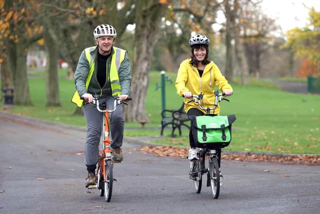
Hide AdStephen McNally of Cycul said: “We’re all aware of Craigavon’s infamous roundabouts – between Lurgan and Portadown – but have you noticed that there are no footpaths alongside these roads, no pedestrians, no traffic lights or zebra crossings? That’s because there is a totally separate network for walkers and cyclists, running under and over the road network.”

In the early 1960s, when Craigavon’s planners were designing the traffic system, they were already aware of the effect increasing traffic was having on communities. They recognised that the young and the old no longer found it safe to travel on foot or bicycle. Therefore, they designed a very sophisticated, separate transport system for Craigavon, using over 40 underpasses and six large bridges, so that walkers and cyclists would never come into contact with cars.”
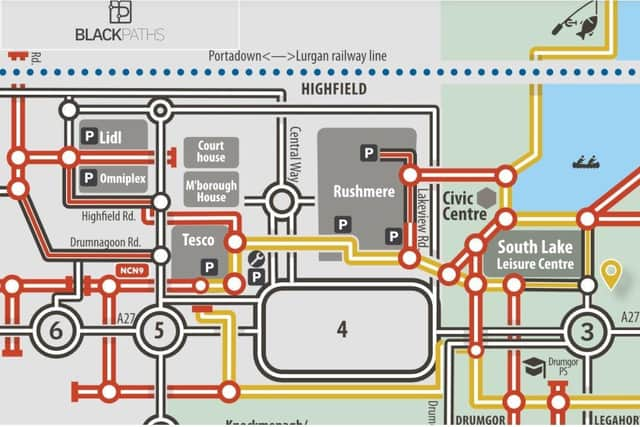
Cycul have spent the winter months researching and mapping the cycle network – known locally as the Black Paths – and have produced a web resource with an active travel map, suggested routes to explore, Google map, news section and a history of the network.
“We hope it helps people appreciate what’s possible above and beneath the busy roads in Craigavon, and persuades them to explore the Black Paths to get to school, go to the shops, the leisure centre, the local industrial estates and train stations at Portadown and Lurgan.
Advertisement
Hide AdAdvertisement
Hide Ad“With the climate crisis, fuel edging toward £2 a litre, and everyone spending more time stuck in traffic – Craigavon is the only place in Northern Ireland (or Ireland) with its own alternative travel system. If the future of transport is active travel, Craigavon arrived there over 50 years ago.”
You can explore the Black Paths by visiting https://blackpaths.org
--
Facts and info
There are 6 large concrete bridges in the Craigavon area, spanning the dual carriageways. None of them are for cars. They are all for pedestrians and cyclists.
There are over 40 underpasses for walkers and cyclists in the Craigavon area.
Advertisement
Hide AdAdvertisement
Hide AdIf you laid all the Black Paths end to end – you could run a marathon on them.
The Black Paths is the longest greenway in Northern Ireland.
The Black Paths were designed and built over 50 years ago – predicting the dangers of increasing traffic.
Belfast has less than 4km of protected cycleways. Craigavon has almost 40km.
Cycul are a social enterprise, not-for-profit company, promoting cycling and active travel. They organise the annual Lap The Lough event around Lough Neagh. www.cycul.cc.
-
-
Comment Guidelines
National World encourages reader discussion on our stories. User feedback, insights and back-and-forth exchanges add a rich layer of context to reporting. Please review our Community Guidelines before commenting.