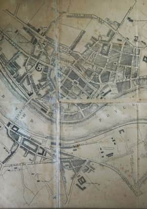
Erstwhile Old Fountain resident forensically dates map to the 1880s


With a forensic nous fitting of CSI, map-collector Hazel, who lived in Little Albert Street until its demolition in the early seventies, has estimated the map dates from between 1880 and 1889.
She explains: “I have a lot of maps in the house and we think it dates from the nine years between 1880 and 1889.
Advertisement
Hide AdAdvertisement
Hide Ad“I’ll tell you why. Wee Albert Street is in the map. That’s where I lived and it was built in 1856 and was there until 1972.
“What’s interesting is that Victoria Street, which runs beside Fountain Place, was built in 1889. It’s not present.
“But Wellington Street is present and it wasn’t built until 1880.”
Asked how she happened to have such detailed knowledge of the streets of the city, Hazel, said that as an erstwhile resident of the old Fountain it was in her genes.
Advertisement
Hide AdAdvertisement
Hide AdSo much so that she has a collection of old maps from the Royal Irish Academy (RIA) in Dublin at home.
She also highly recommends a book by local historian John Bryson, ‘The Streets of Derry, 1625-2001.’