
Storm Bram: Met Office upgrades Northern Ireland weather warning for strong winds to amber level
Multiple agencies across Northern Ireland are on standby as Storm Bram is forecast to bring strong winds throughout most of Tuesday.
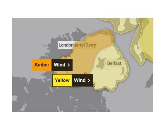
A Met Office yellow weather warning is in place for all counties from 9am to 10pm, while a more severe amber warning for extremely strong winds is now in force from 2pm to 7pm in counties Fermanagh, Londonderry, Tyrone and parts of Co Antrim.
Gusts of around 50-60 mph are possible fairly widely, and potentially in excess of 80 mph in the most exposed areas, especially in the west.
Forecasters say winds are expected to increase further through the afternoon and early evening as Storm Bram tracks to the north of Northern Ireland.

Southerly winds, becoming southwesterly during this period, within the amber warning area may increase to gust 60-70 mph with a chance of 80 mph or more around coasts and over hills for two to three hours, before dropping again. However, winds will continue to be very strong for some time after the amber warning expires.
Police have urged road users to exercise extra caution and reduce speed as heavy rain has resulted in surface water and flooding of roads in many areas.
"Leave plenty of time for your journey - and keep a safe distance between vehicles in front,” a PSNI spokesperson said.
The Department for Infrastructure’s roads and rivers teams have been checking and clearing road gullies and other drainage and infrastructure and have additional staff on standby to respond to incidents.
Monitoring of river levels and sea levels has been ongoing and will continue until the weather warning has elapsed.
As a precautionary measure, Departmental staff are installing temporary flood defences ahead of a forecast tidal surge which will occur close to the time of the high tide which is expected early on Tuesday afternoon. The combination of these two occurrences has the potential to increase water levels in the River Lagan downstream of Stranmillis Weir. When this is further combined with the high flows in the Lagan due to recent rain, engineers have taken the precautionary decision to proactively deploy some of the Belfast Tidal Flood Alleviation Scheme temporary tidal defences between the Stranmillis Weir and the Lagan Weir to provide enhanced flood protection in the area.
Regional Community Resilience Groups have also been advised of weather patterns and to make appropriate preparations.
Members of the public are warned that strong winds could lead to power cuts, damage to buildings, fallen trees, spray or large waves on exposed and vulnerable coastal areas, as well as disruption to travel including public transport, ferries and flights.
Due to the potential for large waves, flooding of coastal roads is also possible especially along the Co Down coast and the worst of the wind is forecast from early afternoon into the evening rush hour. Outdoor seasonal decorations may be vulnerable to the wind.
Traffic disruption is possible with people urged stay up to date with the latest weather and travel advice. Advice and information on the current weather warnings is available at: https://www.nidirect.gov.uk/news/strong-winds-weather-warning-information-and-advice.
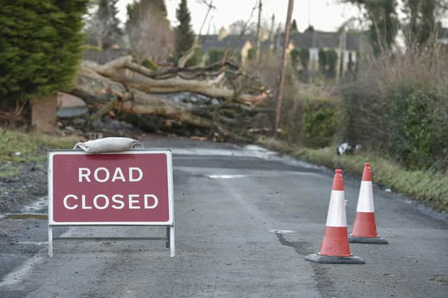
It may be necessary to close some roads or put temporary restrictions in place. Road users are reminded to adhere to road signs and any temporary traffic lights.
To report an obstruction on a road or street | nidirect or call the 24-hour number on 0300 200 7899.
To report incidents of flooding, please contact the flooding incident line on 0300 2000 100. Calls taken by the incident line staff are passed to the relevant responding agency.
People are also warned to be careful near the shorelines, as waves crash against harbour walls, piers and cliffs.
-
-
"It looks spectacular but surges can easily sweep a person off their feet,” a Department for Infrastructure spokesperson said. “All it takes is one wave to drag you out to sea – a dramatic photograph or selfie is not worth risking your life. If you are in trouble or see someone in difficulty at the coast, call 999 and ask for Coastguard.
NIE Networks, meanwhile, is reminding the public to stay clear of any damaged electricity equipment and report it immediately to the Customer Helpline on 03457 643 643. Members of the public should never approach a broken pole or electricity line.
Any customers who experience a power cut they can check for updates at Powercheck NI (powercheck.nienetworks.co.uk) and report the fault online or call the NIE Networks Customer Helpline on 03457 643 643.
Translink advises passengers to check its Journey Planner or Translink social media channels in advance of travel, and to allow extra time for their journeys.