
Storm Chandra: Met Office ice warning issued for Northern Ireland - when warning will be in force
Watch the Met Office forecast, as an ice warning is issued for Northern Ireland.
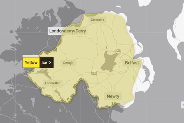
The Met Office has issued an ice warning for Northern Ireland.
The yellow ice warning will be in place from 03:00 to 10:00 on Wednesday January 27.
The warning - which has a medium likelihood and a low impact - reads: “Ice will form overnight Tuesday and may lead to some disruption through Wednesday morning.

“Some injuries from slips and falls on icy surfaces. Probably some icy patches on some untreated roads, pavements and cycle paths.
“Clearing skies Tuesday night will allow temperatures to fall below freezing on Wednesday morning and, after the recent very wet weather, icy patches are likely to develop on some untreated surfaces.”
Met Office Northern Ireland weather forecast
Today (Tuesday January 27)
Cloudy with outbreaks of rain, some hill snow, heavy and persistent. The rain will clear from the southwest by the afternoon. Frequent showers, some heavy, will follow later in the afternoon. Windy with coastal gales east. Maximum temperature 7 °C.
Tonight (Tuesday January 27)
Frequent evening showers clear by midnight leaving the night dry with clear spells. Windy with coastal gales in the east at first. Minimum temperature 2 °C.
Wednesday (January 28)
Most places will see a dry day with bright or sunny spells. Cloud will spread north during the afternoon with showers in the south later. Maximum temperature 7 °C.
Outlook for Thursday (January 29) to Saturday (January 31)
Bright spells with showers at times later Thursday. Outbreaks, rain with hill snow, some heavy Friday. Drier and brighter at first Saturday becoming cloudy with rain later.